Thursday, December 27, 2007

Lisbon

Lisbon is the capital and largest city of Portugal.
In Lisbon had a population of around 564,657.
The greater Lisbon metropolitan area, a large urbanized region that encompasses both sides of the Tajo, had a population of 2 million. Most residents speak Portuguese. Roman Catholicism is the dominant religion.


Lisbon is built on the terraced sides of 7 low hills overlooking the harbor at the wide mouth of the Tajo. The bustling and picturesque Alfama district, the city’s old quarter, is located near the waterfront. The Alfama, which retains its narrow and crooked medieval streets, is one of the few districts of Lisbon to survive the great earthquake of 1755. To the west lies the Baixa (Lower Town), an area completely destroyed by the same earthquake and resulting tsunami (tidal wave). Rebuilt with a grid of parallel streets, the Baixa contains broad, tree-lined avenues, handsome squares, and extensive public gardens. The Bairro Alto (Upper Town) covers a hill west of the Baixa and preserves 17th-century streets, houses, and churches.

The best places for visit in Lisbon are: Lisbon Cathedral, Park of Nations, Lisbon's 18th-Century Elegance...

Cathedral of Lisbon

It is not very rich in itself. But it has an attractive austerity to its architecture and its interior treasures alone make it worth a visit.
Characterized by twin towers flanking its entrance, Lisbon Cathedral is a combination of Romanesque and Gothic styles. The facade is severe enough to resemble a medieval fortress.


national park Lisbon


This is a new up market area of Lisbon. The former grounds of the 'Expo 98' were not left to abandonment and is now called 'Nations Park' (Parque das Nações). Used both during the day and at night, it offers numerous attractions: you can use its promenade by the river for a run, for a walk or just to sit and enjoy the view of Vasco da Gama Bridge; visit some of the pavilions or have an exquisite meal in some of the finest restaurants in town or just have a drink in one of the relaxed bars.

coat of arms Lisbon

Coat of Arms
flag of Lisbon
Flag

Tuesday, December 18, 2007

The seven Wonders of the Ancient World

The Pharos of Alexandria
Of the Seven Wonders of the Ancient World, only one had a practical use in addition to its architectural elegance: The Lighthouse of Alexandria. For sailors, it ensured a safe return to the Great Harbor. For architects, it meant even more: it was the tallest building on Earth. And for scientists, it was the mysterious mirror that fascinated them most... The mirror's reflection could be seen more than 50 km (35 miles) off-shore.

Egypt chart

It is located on the ancient island of Pharos, now a promontory within the city of Alexandria in Egypt.

After the death of Alexander the Great, his commander Ptolemy Soter assumed power in Egypt. He had witnessed the founding of Alexandria, and established his capital there. Off of the city's coast lies a small island: Pharos. Its name, legend says, is a variation of Pharaoh's Island. The island was connected to the mainland by means of a dike - the Heptastadion - which gave the city a double harbor. And because of dangerous sailing conditions and flat coastline in the region, the construction of a lighthouse was necessary.

Pharos Martin Heemskerck

The project was conceived and initiated by Ptolemy Soter around 290 BC, but was completed after his death, during the reign of his son Ptolemy Philadelphus.

Of the six vanished Wonders, the Lighthouse of Alexandria was the last to disappear. Therefore we have adequately accurate knowledge of its location and appearance. Ancient accounts such as those by Strabo and Pliny the Elder give us a brief description of the "tower" and the magnificent white marble cover. They tell us how the mysterious mirror could reflect the light tens of kilometers away. Legend says the mirror was also used to detect and burn enemy ships before they could reach the shore.

The Colossus of Rhodes
From its building to its destruction lies a time span of merely 56 years. Yet the colossus earned a place in the famous list of Wonders. "But even lying on the ground, it is a marvel", said Pliny the Elder. The Colossus of Rhodes was not only a gigantic statue. It was rather a symbol of unity of the people who inhabited that beautiful Mediterranean island -- Rhodes.

It is located at the entrance of the harbor of the Mediterranean island of Rhodes in Greece.

Throughout most of its history, ancient Greece was comprised of city-states which had limited power beyond their boundary. On the small island of Rhodes were three of these: Ialysos, Kamiros, and Lindos. In 408 BC, the cities united to form one territory, with a unified capital, Rhodes. The city thrived commercially and had strong economic ties with their main ally, Ptolemy I Soter of Egypt. In 305 BC, the Antigonids of Macedonia who were also rivals of the Ptolemies, besieged Rhodes in an attempt to break the Rhodo-Egyptian alliance. They could never penetrate the city. When a peace agreement was reached in 304 BC, the Antagonids lifted the siege, leaving a wealth of military equipment behind. To celebrate their unity, the Rhodians sold the equipment and used the money to erect an enormous statue of their sun god, Helios.

colossus
Let us first clear a misconception about the appearance of the Colossus. It has long been believed that the Colossus stood in front of the Mandraki harbor, one of many in the city of Rhodes, straddling its entrance. Given the height of the statue and the width of the harbor mouth, this picture is rather impossible than improbable. Moreover, the fallen Colossus would have blocked the harbor entrance. Recent studies suggest that it was erected either on the eastern promontory of the Mandraki harbor, or even further inland. Anyway, it did never straddle the harbor entrance.

The project was commissioned by the Rhodian sculptor Chares of Lindos. To build the statue, his workers cast the outer bronze skin parts. The base was made of white marble, and the feet and ankle of the statue were first fixed. The structure was gradually erected as the bronze form was fortified with an iron and stone framework. To reach the higher parts, an earth ramp was built around the statue and was later removed. When the colossus was finished, it stood about 33 m (110 ft) high. And when it fell, "few people can make their arms meet round the thumb", wrote Pliny.

The Mausoleum at Halicarnassus
Similar to the Great Pyramid, we are now visiting the burial place of an ancient king. Yet the Mausoleum is different - so different from the Pyramid that it earned its reputation - and a spot within the list - for other reasons. Geographically, it is closer to the Temple of Artemis... And it was the beauty of the tomb rather than its size that fascinated its visitors for years.

When the Persians expanded their ancient kingdom to include Mesopotamia, Northern India, Syria, Egypt, and Asia Minor, the king could not control his vast empire without the help of local governors or rulers -- the Satraps. Like many other provinces, the kingdom of Caria in the western part of Asia Minor (Turkey) was so far from the Persian capital that it was practically autonomous. From 377 to 353 BC, king Mausollos of Caria reigned and moved his capital to Halicarnassus. Nothing is exciting about Maussollos life except the construction of his tomb. The project was conceived by his wife and sister Artemisia, and the construction might have started during the king's lifetime. The Mausoleum was completed around 350 BC, three years after Maussollos death, and one year after Artemisia's.


colossus

The structure was rectangular in plan, with base dimensions of about 40 m (120 ft) by 30 m (100 ft). Overlying the foundation was a stepped podium which sides were decorated with statues. The burial chamber and the sarcophagus of white alabaster decorated with gold were located on the podium and surrounded by Ionic columns. The colonnade supported a pyramid roof which was in turn decorated with statues. A statue of a chariot pulled by four horses adorned the top of the tomb.

The Statue of Zeus at Olympia
This is the statue of the god in whose honor the Ancient Olympic games were held. It was located on the land that gave its very name to the Olympics. At the time of the games, wars stopped, and athletes came from Asia Minor, Syria, Egypt, and Sicily to celebrate the Olympics and to worship their king of gods: Zeus.

It is located at the ancient town of Olympia, on the west coast of modern Greece, about 150 km west of Athens.

The ancient Greek calendar starts in 776 BC, for the Olympic games are believed to have started that year. The magnificent temple of Zeus was designed by the architect Libon and was built around 450 BC. Under the growing power of ancient Greece, the simple Doric-style temple seemed too mundane, and modifications were needed. The solution: A majestic statue. The Athenian sculptor Pheidias was assigned for the "sacred" task, reminiscent of Michelangelo's paintings at the Sistine Chapel.
zeusgoldstatue
Pheidias began working on the statue around 440 BC. Years earlier, he had developed a technique to build enormous gold and ivory statues. This was done by erecting a wooden frame on which sheets of metal and ivory were placed to provide the outer covering. Pheidias' workshop in Olympia still exists, and is coincidentally -- or may be not -- identical in size and orientation to the temple of Zeus. There, he sculpted and carved the different pieces of the statue before they were assembled in the temple.

The Temple of Artemis at Ephesus
Is it simply a temple? How could it take its place among other unique structures such as the Pyramid, the Hanging Gardens, and the Colossus of Rhodes? For the people who actually visited it, the answer was simple. It was not just a temple... It was the most beautiful structure on earth... It was built in honor of the Greek goddess of hunting and wild nature. That was the Temple of Artemis (Diana) at Ephesus.

The ancient city of Ephesus is located near the modern town of Selcuk, about 50 km south of Izmir (Smyrna) in Turkey.

Although the foundation of the temple dates back to the seventh century BC, the structure that earned a spot in the list of Wonders was built around 550 BC. Referred to as the great marble temple, or temple D, it was sponsored by the Lydian king Croesus and was designed by the Greek architect Chersiphron. It was decorated with bronze statues sculpted by the most skilled artists of their time: Pheidias, Polycleitus, Kresilas, and Phradmon.

petra4-BradMering

The foundation of the temple was rectangular in form, similar to most temples at the time. Unlike other sanctuaries, however, the building was made of marble, with a decorated façade overlooking a spacious courtyard. Marble steps surrounding the building platform led to the high terrace which was approximately 80 m (260 ft) by 130 m (430 ft) in plan. The columns were 20 m (60 ft) high with Ionic capitals and carved circular sides. There were 127 columns in total, aligned orthogonally over the whole platform area, except for the central cella or house of the goddess.

The Hanging Gardens of Babylon
Fruits and flowers... Waterfalls... Gardens hanging from the palace terraces... Exotic animals... This is the picture of the Hanging Gardens of Babylon in most people's minds. It may be surprising to know that they might have never existed except in Greek poets and historians imagination!

Location:
On the east bank of the River Euphrates, about 50 km south of Baghdad, Iraq.

The Babylonian kingdom flourished under the rule of the famous King, Hammurabi (1792-1750 BC). It was not until the reign of Naboplashar (625-605 BC) of the Neo-Babylonian dynasty that the Mesopotamian civilization reached its ultimate glory. His son, Nebuchadnezzar II (604-562 BC) is credited for building the legendary Hanging Gardens. It is said that the Gardens were built by Nebuchadnezzar to please his wife or concubine who had been "brought up in Media and had a passion for mountain surroundings".

hanging_gardens

Detailed descriptions of the Gardens come from ancient Greek sources, including the writings of Strabo and Philo of Byzantium. Here are some excerpt from their account:

"The Garden is quadrangular, and each side is four plethra long. It consists of arched vaults which are located on checkered cube-like foundations.. The ascent of the uppermost terrace-roofs is made by a stairway..."

The Great Pyramid of Giza
It is the one and only Wonder which does not require a description by early historians and poets. It is the one and only Wonder that does not need speculations concerning its appearance, size, and shape. It is the oldest, yet it is the only surviving of the Seven Ancient Wonders. It is the Great Pyramid of Giza.

Location:
At the city of Giza, a necropolis of ancient Memphis, and today part of Greater Cairo, Egypt.

Contrary to the common belief, only the Great Pyramid of Khufu (Cheops), not all three Great Pyramids, is on top of the list of Wonders. The monument was built by the Egyptian pharaoh Khufu of the Fourth Dynasty around the year 2560 BC to serve as a tomb when he dies. The tradition of pyramid building started in Ancient Egypt as a sophistication of the idea of a mastaba or "platform" covering the royal tomb. Later, several stacked mastabas were used. Early pyramids, such as the Step Pyramid of King Zoser (Djoser) at Saqqara by the famous Egyptian architect, Imhotep, illustrate this connection.


Giza Pyramids

When it was built, the Great pyramid was 145.75 m (481 ft) high. Over the years, it lost 10 m (30 ft) off its top. It ranked as the tallest structure on Earth for more than 43 centuries, only to be surpassed in height in the nineteenth century AD. It was covered with a casing of stones to smooth its surface (some of the casing can still be seen near the top of Khefre's pyramid). The sloping angle of its sides is 54 degrees 54 minutes. Each side is carefully oriented with one of the cardinal points of the compass, that is, north, south, east, and west. The horizontal cross section of the pyramid is square at any level, with each side measuring 229 m (751 ft) in length. The maximum error between side lengths is astonishingly less than 0.1%.

The structure consists of approximately 2 million blocks of stone, each weighing more than two tons. It has been suggested that there are enough blocks in the three pyramids to build a 3 m (10 ft) high, 0.3 m (1 ft) thick wall around France. The area covered by the Great pyramid can accommodate St Peter's in Rome, the cathedrals of Florence and Milan, and Westminster and St Paul's in London combined.


Sunday, December 2, 2007

Dublin

Dublin is the largest city in Ireland and the capital of the Republic of Ireland. It is located near the midpoint of Ireland's east coast, at the mouth of the River Liffey and at the centre of the Dublin Region. Founded as a Viking settlement, the city has been Ireland's primary city for most of the island's history since medieval times. Today, it is an economic, administrative and cultural centre for the island of Ireland, and has one of the fastest growing populations of any European capital city.

Dublin

The name Dublin is a Hiberno-English derivative of 'Dubh Linn' (Irish, dubh -> black, and linn -> pool). Historically, in the traditional Gaelic script used for the Irish language, 'bh' was written with a dot over the 'b', viz 'Du Linn' or 'Dulinn'. The French-speaking Normans omitted the dot and spelled the name variously as 'Develyn' or 'Dublin'.


The headquarters of almost all of Ireland's sporting organisations are in Dublin, and the most popular sports in Dublin are those that are most popular throughout Ireland: Gaelic football, Soccer, Rugby Union and Hurling.
Dublin

Dublin enjoys a maritime temperate climate characterised by mild winters, cool summers, and a lack of temperature extremes. Contrary to popular belief, Dublin does not experience as high rainfall as the West of Ireland, which receives twice that of the capital city. Dublin has fewer rainy days, on average, than London. The average maximum January temperature is 8 °C, the average maximum July temperature is 20 °C. The sunniest months, on average, are May and June. (info. taken from wikipedia.)

Friday, November 23, 2007

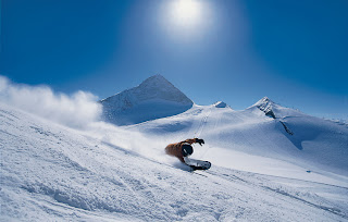
Top 5 ski-destinations in Austria

Stubai

Winter fans won´t have any regrets in the Stubaivalley: In Austria´s biggest glacier skiing area, with absolute snow guarantee from October to June, 100km of dream - like pistes make sure that there is "pow(d)er snow" the whole year through. The Ski Club Mickey Mouse in Neustift, for ski fans from 4 years of age, is unique in the whole of Austria.Stubai
In Fulpmes the little snow fans can enjoy themselves in Ronny`s children`s land.
Mega - strong après ski and fun in traditional huts, make the Stubaivalley a hot tip for winter fans. A valley that combines sport and nightlife in a dreamlike landscape.


Schladming

Mile long slopes and beautiful cross-country trails are waiting for you in and around Schladming-Rohrmoos.
Schladming – the Styrian sport-city and Rohrmoos the family-ski-region in the Dachstein-Tauern-Reguion, is one of the biggest ski-regions in Austria.

It´s known very well even external of Austria because of the international world cup-races.

Schladming
The 4 ski mountains in the Dachstein-Tauern-Region offers 167 slope-kilometers and 90 ski-lifts. (Hauser Kaibling, Planai, Hochwurzen and Reiteralm)
A particular adventure is the Dachstein glacier – 3000 km freedom – Dachstein Skywalk – panorama-restaurant – Dachstein Super Snowboard Park – Cross-country-skiing with no limit, skiing at the 6 lift-arrangements and there is snow the whole year.

Did you know that you can go skiing even in the night. The 3 km lighted slope on the Hochwurzen makes this possible.
About 60 km of quality-cross country ski trails with shimmering names like “crystal-trail” in a very romantic ambience are waiting for you in Schladming-Rohrmoos. 50 km winter-hiking-paths invites to stroll and for nordic walking. The big cross-country-area Ramsau is just a few kilometres away.
An adventure is the 7 km long nature-toboggan-run, which is opened at night and on the day.


Bad Kleinkirchheim

Winter holidays can be great family holidays. At last, spending time together – sharing holiday experiences, relaxing and enjoying being with each other. Bad Kleinkirchheim in Carinthia’s Nockbergen is the number one choice for families with children, and grandparents, too!
The reasons are obvious:
The soft, harmonic topography of the Nockberge makes for many great child and family-friendly pistes. The ski-run choices are excellent for families, ranging on the whole from easy to intermediate levels. Alternatively, how about sledging on the lit-up toboggan run near the Kaiserburg? 60 kilometres of winter hiking tracks and cross-country tracks provide plenty of fun, and so does the ice rink. And following a fun-filled day in the snow, the healing and soothing of the thermal spring waters offer bathing fun for young and old alike.
bad kleinkirchheim


Flachau

Flachau - the stamping grounds of Hermann Maier - is considered to be the most innovative and modern of skiing areas. Your heart will skip a beat when you see the selective range of ski runs, excellently groomed slopes and the fantastic alpine panorama. Snow Space Flachau with its manifold possibilities of things to do is the very heart of Ski Amade, and is the perfect destination for those seeking pleasure, fun and excitement. At long last out there in the open - out there skiing! Tank up on ski-power and energy!

Flachau"

Broad, perfectly groomed ski slopes ensure the ultimate in pleasure. A variety packed choice of slopes promises the perfect ability level for each and every skier. All types of slopes are to be found here - from the world cup piste, time-yourself run, the flood-lit slope, to family runs and practice slopes. 3 lower-station stops enable individual boarding, translating to skiing fun right down into the village. 21 skiing lodges, mountain restaurants and sun-terraces allow you to top off your day perfectly in accordance to your personal wishes - from cosy rustic ambience to totally hot apres-ski fervour.

Snow Space Flachau is considered to be the most innovative and modern of skiing areas. The latest in cable cars and the ultimate in cable car technology ensure the best in comfort and security.


Hintertux

Holidays in Tux will be spent relaxing and enjoying new experiences day by day. Exceptional surroundings and a huge choice of activities provide the foundations for an unforgettable holiday experience!
That “special something” in Tux can be attributed to a unique combination of stunning natural landscapes, warm hospitality and authentic tradition.
At an amazing level, between 1,300 and 3,250 m altitude lies the village of Tux, idyllically situated at the end of Zillertal and just before the majestic Hintertuxer Glacier.
Tux streches over 8 km and comprises of the villages of Tux-Vorderlanersbach, Tux-Lanersbach, Juns, Madseit and Hintertux.


Hintertux snowboard

The villages of Tux are small and characteristically Tyrolean, which combined with the Hintertux Glacier at the head of the valley, form a nature and sports paradise for the whole family - 365 days a year!
The Tux Sportbus is a free shuttle service which operates 365 days of the year taking guests from Vorderlanersbach to Hintertux for free! In winter the Tux Nightbus "50 Cent-Night-Liner" operates until 02.20 a.m.

Friday, November 16, 2007

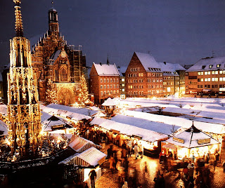
Advent in Vienna

Advent in Vienna
Advent in Vienna

Time before Christmas is always fill with love and peace. Lights are flashing in black and peaceful night. The temperature is very low, but your feel warmth around your hart. This sentences before describe time before Christmas in Vienna, or popular known as "Advent in Vienna".

The capital city of Austria is like every year decorated with idiot lights and other adornment. The adornment are very expensive and city administration spend every year around 2,5 mil euros for decoration of town. There is a very famous Christmas market where you can buy everything for Christmas. You can buy there presents for your family and people whose you love, but you can also buy some adornment for Christmas tree. If you want give something special to people whose you love, try give them more time for friendship and laugh.

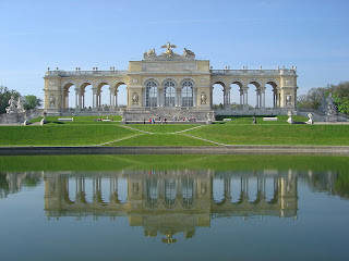
If you go to Vienna you must to visit this places: The Gloriette at Schönbrunn, The Secession building, Stephansdom, Naturhistorisches Museum.

Thursday, September 6, 2007

Frankfurt

frankfurt at the night
Frankfurt at the night


Frankfurt am Main is the largest city in the German state of Hessen and the fifth-largest city in Germany after Berlin, Hamburg, Munich and Cologne, with an end-2006 population of 661,877. The urban area had an estimated population of 1,468,140 in 2000. The city is at the center of the larger Frankfurt Rhine Main Area which has a population of 5 million and is Germany's second largest metropolitan area.

Situated on the river Main , Frankfurt is the financial and transportation centre of Germany. Frankfurt is the place of residence of the Europen Central Bank, the Frankfurt Stock Exchange and is one of the two largest financial centres in continental Europe (the other one being Paris). Frankfurt was named Europe's richest city in 2001 as measured by GPD per capit. It is also listed as one of nine Alpha world cities.

Among English speakers the city is commonly known simply as "Frankfurt", though Germans occasionally call it by its full name when it is necessary to distinguish it from the other (significantly smaller) Frankfurt in the German state of Brandenburg, known as Frankfurt. It was once called Frankfort-on-the-Main in English, a translation of Frankfurt am Main.

Monday, September 3, 2007

Best places in Vienna...

The statue of Athena in front of the Austrian Parliament

The Secession building

Rathaus
The Rathaus

The Gloriette at Schönbrunn

Stephansdom
Stephansdom

Albertina
Albertina

Naturhistorisches Museum

Basic about Vienna

Map of Vienna
Map of Vienna

Vienna (German: Wien [viːn], Austro-Bavarian is the capital of Austria, and also one of the nine States of Austria. Vienna is Austria's primate city; with a population of about 1.7 million (2.3 million within the metropolitan area), and is by far the largest city in Austria as well as its cultural, economic and political centre. Vienna lies in the very east of Austria and is close to the Czech Republic, Slovakia and Hungary. In 2001, the city centre was designated a UNESCO World Heritage Site and an Economist Intelligence Unit study of 127 world cities ranked it third for quality of life.


Religions:
Roman Catholic 49.2%
No religion 25.7%
Muslim 7.8%
Orthodox 6.0%
Protestant (mostly Lutheran) 4.7%
Jewish 0.5%
Other or none indicated 6.3%

Art and culture have a long tradition in Vienna, including theatre, opera, classical music and fine arts. The Burgtheater is considered one of the best theatres in the German-speaking world alongside its branch, the Akademietheater. The Volkstheater Wien and the Theater in der Josefstadt also enjoy good reputations. There is also a multitude of smaller theatres, in many cases devoted to less mainstream forms of performing arts, such as modern, experimental plays or cabaret.

Vienna (Wien)

State coat of arms Vienna
Coat of arms

Flag of Vienna
Flag of Vienna

Vienna is Founded around 500 BC, Vienna was originally a Celtic settlement. In 15BC, Vienna became a Roman frontier city guarding the Roman Empire against Germanic tribes to the north.

During the Middle Ages, Vienna was home of the Babenberg Dynasty and in 1440 became residence city of the Habsburg dynasties from where Vienna eventually grew to become the capital of the Holy Roman Empire and a cultural centre for arts and science, music and fine cuisine. The Ottoman invasions of Europe in the 16th and 17th centuries were stopped twice just outside Vienna.

In1805, Vienna became capital of the Austrian Empire and continued to play a major role in European and World politics, including hosting the 1815 Congress of Vienna.

In 1918, after World War I, Vienna became capital of the First Austrian Republic. During the 1920s and 1930s it was a bastion of Socialism in Austria, and became known as "Red Vienna".

In 1945, the Vienna Offensive was successfully launched by the Soviets against the Germans holding Vienna. The city was besieged for about two weeks before it fell to the Soviets. After 1945, Vienna again became the capital of Austria. It was initially divided into four zones by the 4 Powers and was governed by the Allied Commission for Austria.

In the 1970s Austrian Chancellor Bruno Kreisky inaugurated the creation of the Vienna International Center, a new area of the city created to host international institutions. Vienna has regained a part of its former international relevance by hosting such international organizations as the United Nations (UNIDO, UNOV and UNODC), the International Atomic Energy Agency, the Organization of Petroleum Exporting Countries, and the Organization for Security and Cooperation in Europe.

Saturday, August 25, 2007

National park North Velebit (CRO)

National park North Velebit

North Velebit is the youngest of the Croatian national parks, established in 1999. It comprises the most attractive and, in terms of nature, the most valuable areas of the northern part of Velebit. A large number of attractive sights are concentrated in this predominantly mountainous park - magnificent carst forms of Hajdučki and Rožanski kukovi, unique botanical garden and Lukina cave, one of the longest in the world. Croatian mountaineers consider this area the greatest jewel among the Croatian mountains. Due to its remoteness from the main roads, this area is somewhat less visited, but this only increases its mystic and primeval natural ambience.

The National park North Velebit is heaven on the Earth for all which like nature, quite and caves.

National park Risnjak (CRO)

National park Risnjak

The Risnjak National Park is located in Gorski kotar, the most wooded part of western Croatia. It lies between latitude 45°24' and 45°32' north and longitude 14°33'30" and 14°43'30" east, in the immediate vicinity of the Adriatic Sea, only 15 km north-east from Rijeka. The Park covers an area of 63,5 km2 including the central part of the Risnjak and Snježnik massif, as well as the upper flow of the river Kupa with its source area. The area of the Risnjak massif was proclaimed a national park in 1953, at the suggestion of an eminent Croatian natural scientist and researcher of Risnjak.

Large migrations of Alpine, arctic and boreal species moved across the Risnjak and Snježnik massif towards southeast, on these mountains a vegetation substantially different from the one in the Alps has been preserved. Due to various climatic, geologic, petrographic and other factors, a very heterogeneous flora and fauna has been preserved in this area. The Park is made mostly of limestone and dolomite with major karst features (karren on bare rocks, rock falls, sinkholes, swallow holes, caves etc.).

The highest peak of the NP "Risnjak" - Veliki Risnjak - is only 1528 m high, but this massif together with the contiguous Snježnik massif (1506 m) is nevertheless a great climatic and vegetational barrier between coastal and continental parts of Croatia. Climatic influences from the Adriatic Sea penetrating from the nearby Kvarner bay and the continental influences penetrating through the Kupa valley collide here and play a significant role in determining the specific climate of the NP "Risnjak" with pleasantly warm summers and an average temperature up to 20°C, rainy springs an autums, and long, cold snowy winters. At the Risnjak mountain lodge, snow lies for full five months, sometimes up to 4 m deep.

National park Plitvice lakes (CRO)

National park Plitvice lakes

Plitvička Jezera (Plitvice Lakes, in English) is a municipality (općina) in central Croatia, in the eastern part of the Lika-Senj county. It is crossed by the Zagreb–Split main road. Its total area is 539.08 km². The main town and seat of the municipality is Korenica. The lakes are situated on the eponymous Plitvice plateau, between the mountains of Lička Plješevica (Gornja Plješevica peak 1,640 m), Mala Kapela (Seliški Vrh peak at 1,280 m) and Medveđak (884 m).
The sixteen lakes are separated into an upper and lower cluster formed by runoff from the mountains, descending from an altitude of 636 m to 503 m over a distance of some 8 km, aligned in a south-north direction. The lakes collectively cover an area of about 2 km², with the water exiting from the lowest lake to form the Korana river.

The Plitvice Lakes lie in a basin of karstic rock, mainly dolomite and limestone, which has given rise to their most distinctive feature. The lakes are separated by natural dams of travertine, which is deposited by the action of moss, algae and bacteria. The encrusted plants and bacteria accumulate on top of each other, forming travertine barriers which grow at the rate of about 1 cm per year.

The lakes are renowned for their distinctive colours, ranging from azure to green, grey or blue. The colours change constantly depending on the quantity of minerals or organisms in the water and the angle of sunlight.

National park Paklenica (CRO)

National park Paklenica

The Paklenica karst river canyon is a national park in Croatia. It is located at 44°22′N, 15°26′E in Starigrad, northern Dalmatia. With its surface area of 96 km2, from the eastern coast of the Adriatic Sea to the highest peaks of the Velebit Mountains, Vaganski Vrh (1757 m) and Sveto Brdo (1753 m), Paklenica abounds with numerous natural wonders and phenomena, which is why the entire area was proclaimed a national park in 1949. And rightfully so, as this region is simple and unusual in its connection between the sea and the mountains, rich in beech and black pine forests, its deep canyons cut vertically into the Velebit ridge, its karst formations and numerous caves and pits.

Vaganski vrh, the highest peak of Velebit at 175 m, is located within the borders of the national park, and also is the peak Sveto brdo (Holy mountain) - 1753m. From the Sveto brdo there is the beautiful view of the southern slopes, as this is the last really high peak at Velebit. At the top, there is a cross. Today there is a dispute in the Croatian Mountaineering Association as to whether this is the right way to mark mountain peaks.

National park Paklenica is best place for all people which like nature, especially for alpinists and free-climber, and if you visit Paklenica you will come back.

National park Mljet (CRO)

National park Mljet

Mljet lies south of the Pelješac peninsula, from which it is divided by the Mljet Channel.Mljet is an elongated island, with an average width of 3 km, 37 km long. It is an Island of great diversity and contrast, and "Mljet" National Park covers his northwestern part with an area of 5.375 ha of protected land and surrounding sea. This area was proclaimed as national park 11 November 1960 and represents the first institutionalized attempt to protect an original ecosystem in the Adriatic.

Mljet's fauna is particularly friendly because there are no poisonous snakes (e.g. horned viper) thanks to the introduction of the Indian Mongoose, which wiped them out. Five species of snakes and six species of lizards have been registered on the island to date. Mljet's largest daylight bird predator, the Snake eagle, feeds on snakes and lizards. There are also many song-birds, as well as several species of birds in the forest that do not normally live on the Adriatic islands.

It is perfect place for all people which like peace, quite and nature. It can be your holiday from dream if you need place to relax.

National park Krka (CRO)

national park krka

The Krka National Park is a spacious, largely unchanged region of exceptional and multifaceted natural value, and includes one or more preserved or insignificantly altered ecosystems.

It is intended primarily for scientific, cultural, educational, recreational,
and tourism activities such as visiting and sightseeing.
It was proclaimed a national park in 1985 and is the 7. national
park in Croatia.

The Krka National Park is located entirely within the territory of Šibnik-
Knin County and encompasses an area of 109 square kilometers along
the Krka River: two kilometers downriver from Knin to Skradin and the lower part of the Čikola River.
From the flooded part of the mouth, it is 72.5 kilometers in length,
making the Krka the 22nd longest river in Croatia.

The source of the Krka River is at the base of the Dinaric Mountains, 3.5 kilometers northeast of the base of Knin and 22 meters below Topoljski Slap, Veliki Buk and Krčić Slap, which are noisy cascades in the winter but run dry during the summer.

The length of the freshwater section of the river is 49 kilometers and that
of the brackish section is 23.5 kilometers.
Significant tributaries of the Krka River include Krčić, Kosovčica,
Orašnica, Butišnica and Čikola with Vrb.
With its seven travertine waterfalls and a total drop of 242 meters,
the Krka River is a natural and karstic phenomenon.
(this informations are taken from www(.)npkrka(.)hr.

National park Kornati (CRO)

kornati


kornati

The Kornati archipelago consists of 140 islands, islets and cliffs, with 89 of them declared a National Park because of its natural beauty due to its numerous coves and crystal clear blue waters. It spreads over a surface of 220m2 and declared a national park in 1980 due to its unique shape and beauty. There are no permanent residents of the islands and most of the area belongs to the people of Murter island who come to tend the olive groves, orchards and the vineyards. They have cottages (small house) there, which nowdays mostly are offered as tourist accommodation units, specialized for robinson style holidays (self cattering houses with no electic power and running water).
In the National Park Kornati there are around 30 piers and about 20 places where guests can try wonderful traditional cuisine and seafood.
From the marina, guests can find shelter on the island Zutu which is mainly uninhabited except for a few houses which are lived in from time to time and can be rented out to those who enjoy seclusion, better known as Robinson tourism. Robinson tourism is developing and guests are left to enjoy the beauty and quiet of Kornati.

This region is ideal for water sports like water-polo,swimming, water-skiing... The marina on the island Piskera is located in a small inlet which is protected from the open sea by three smaller islands. Guests will find a restaurant which offers original seafood specialties and will feel right at home in Robinson tourism. The island Lavsa also offers shelter to anyone sailing by. The island Purara is an especially preservekkkd area- an island in the heart of the national park known to be an ornithological and floristical reserve. That is why approaching the island and coming to shore are prohibited.

National park Brijuni (CRO)

National park Brioni

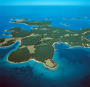
Brijuni or Brioni are a group of 14 lager and small islands in the Croatian part of the northern Adriatic Sea, separated from the west coast of the Istrian peninsula by the narrow Fažana Strait. The largest island, Veli Brijun ("Big Brijun") (5.6 km²), lies 2 km off the coast. Famous for their scenic beauty, the islands are a holiday resort and a Croatian National Park.
Brijuni were proclaimed a national park in 1983.The islands abound with Mediterranean and sub-Mediterranean vegetation, where tourists can take in the surroundings of untouched nature. The island has a zoo, pheasant farm and safari park with numerous diverse forms of animal life from throughout the world.Traces of human inhabitation on the island date back to the earlier neolithic period and among the many archaeological sites, the most significant is the pre-historic settlement on Gradina hill.

Friday, August 24, 2007

National parks in Croatia

National parks of Croatia
National parks of Croatia.

In next posts for all nature lovers I will describe 8 national parks of Croatia. For begin it is very important to say what actually words "NATIONAL PARK" mean. Because of that I have given the definition of national park.

"National park is an area less affected by human exploitation and occupation, with sites of particular scenic or scientific interest, which is protected by a national authority."

Best places in London to visit!

Buckingham Palace
Buckingham Palace

The Palace of Westminster

The Millennium Bridge

Tower Bridge
Tower Bridge

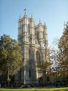
Westminster Abbey
Westminster Abbey

Wembley Stadium
Wembley Stadium

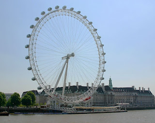
London Eye
London Eye

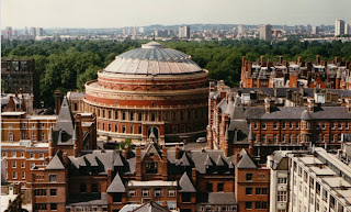
The Royal Albert Hall

Royal Holloway
Royal Holloway

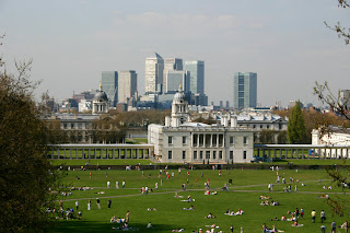
Greenwich Park
Greenwich Park

City Hall London
City Hall
eXTReMe Tracker