Saturday, August 25, 2007
National park North Velebit (CRO)
North Velebit is the youngest of the Croatian national parks, established in 1999. It comprises the most attractive and, in terms of nature, the most valuable areas of the northern part of Velebit. A large number of attractive sights are concentrated in this predominantly mountainous park - magnificent carst forms of Hajdučki and Rožanski kukovi, unique botanical garden and Lukina cave, one of the longest in the world. Croatian mountaineers consider this area the greatest jewel among the Croatian mountains. Due to its remoteness from the main roads, this area is somewhat less visited, but this only increases its mystic and primeval natural ambience.
The National park North Velebit is heaven on the Earth for all which like nature, quite and caves.
National park Risnjak (CRO)
The Risnjak National Park is located in Gorski kotar, the most wooded part of western Croatia. It lies between latitude 45°24' and 45°32' north and longitude 14°33'30" and 14°43'30" east, in the immediate vicinity of the Adriatic Sea, only 15 km north-east from Rijeka. The Park covers an area of 63,5 km2 including the central part of the Risnjak and Snježnik massif, as well as the upper flow of the river Kupa with its source area. The area of the Risnjak massif was proclaimed a national park in 1953, at the suggestion of an eminent Croatian natural scientist and researcher of Risnjak.
Large migrations of Alpine, arctic and boreal species moved across the Risnjak and Snježnik massif towards southeast, on these mountains a vegetation substantially different from the one in the Alps has been preserved. Due to various climatic, geologic, petrographic and other factors, a very heterogeneous flora and fauna has been preserved in this area. The Park is made mostly of limestone and dolomite with major karst features (karren on bare rocks, rock falls, sinkholes, swallow holes, caves etc.).
The highest peak of the NP "Risnjak" - Veliki Risnjak - is only 1528 m high, but this massif together with the contiguous Snježnik massif (1506 m) is nevertheless a great climatic and vegetational barrier between coastal and continental parts of Croatia. Climatic influences from the Adriatic Sea penetrating from the nearby Kvarner bay and the continental influences penetrating through the Kupa valley collide here and play a significant role in determining the specific climate of the NP "Risnjak" with pleasantly warm summers and an average temperature up to 20°C, rainy springs an autums, and long, cold snowy winters. At the Risnjak mountain lodge, snow lies for full five months, sometimes up to 4 m deep.
National park Plitvice lakes (CRO)
Plitvička Jezera (Plitvice Lakes, in English) is a municipality (općina) in central Croatia, in the eastern part of the Lika-Senj county. It is crossed by the Zagreb–Split main road. Its total area is 539.08 km². The main town and seat of the municipality is Korenica. The lakes are situated on the eponymous Plitvice plateau, between the mountains of Lička Plješevica (Gornja Plješevica peak 1,640 m), Mala Kapela (Seliški Vrh peak at 1,280 m) and Medveđak (884 m).
The sixteen lakes are separated into an upper and lower cluster formed by runoff from the mountains, descending from an altitude of 636 m to 503 m over a distance of some 8 km, aligned in a south-north direction. The lakes collectively cover an area of about 2 km², with the water exiting from the lowest lake to form the Korana river.
The Plitvice Lakes lie in a basin of karstic rock, mainly dolomite and limestone, which has given rise to their most distinctive feature. The lakes are separated by natural dams of travertine, which is deposited by the action of moss, algae and bacteria. The encrusted plants and bacteria accumulate on top of each other, forming travertine barriers which grow at the rate of about 1 cm per year.
The lakes are renowned for their distinctive colours, ranging from azure to green, grey or blue. The colours change constantly depending on the quantity of minerals or organisms in the water and the angle of sunlight.
National park Paklenica (CRO)
The Paklenica karst river canyon is a national park in Croatia. It is located at 44°22′N, 15°26′E in Starigrad, northern Dalmatia. With its surface area of 96 km2, from the eastern coast of the Adriatic Sea to the highest peaks of the Velebit Mountains, Vaganski Vrh (1757 m) and Sveto Brdo (1753 m), Paklenica abounds with numerous natural wonders and phenomena, which is why the entire area was proclaimed a national park in 1949. And rightfully so, as this region is simple and unusual in its connection between the sea and the mountains, rich in beech and black pine forests, its deep canyons cut vertically into the Velebit ridge, its karst formations and numerous caves and pits.
Vaganski vrh, the highest peak of Velebit at 175 m, is located within the borders of the national park, and also is the peak Sveto brdo (Holy mountain) - 1753m. From the Sveto brdo there is the beautiful view of the southern slopes, as this is the last really high peak at Velebit. At the top, there is a cross. Today there is a dispute in the Croatian Mountaineering Association as to whether this is the right way to mark mountain peaks.
National park Paklenica is best place for all people which like nature, especially for alpinists and free-climber, and if you visit Paklenica you will come back.
National park Mljet (CRO)
Mljet lies south of the Pelješac peninsula, from which it is divided by the Mljet Channel.Mljet is an elongated island, with an average width of 3 km, 37 km long. It is an Island of great diversity and contrast, and "Mljet" National Park covers his northwestern part with an area of 5.375 ha of protected land and surrounding sea. This area was proclaimed as national park 11 November 1960 and represents the first institutionalized attempt to protect an original ecosystem in the Adriatic.
Mljet's fauna is particularly friendly because there are no poisonous snakes (e.g. horned viper) thanks to the introduction of the Indian Mongoose, which wiped them out. Five species of snakes and six species of lizards have been registered on the island to date. Mljet's largest daylight bird predator, the Snake eagle, feeds on snakes and lizards. There are also many song-birds, as well as several species of birds in the forest that do not normally live on the Adriatic islands.
It is perfect place for all people which like peace, quite and nature. It can be your holiday from dream if you need place to relax.
National park Krka (CRO)
The Krka National Park is a spacious, largely unchanged region of exceptional and multifaceted natural value, and includes one or more preserved or insignificantly altered ecosystems.
It is intended primarily for scientific, cultural, educational, recreational,
and tourism activities such as visiting and sightseeing.
It was proclaimed a national park in 1985 and is the 7. national
park in Croatia.
The Krka National Park is located entirely within the territory of Šibnik-
Knin County and encompasses an area of 109 square kilometers along
the Krka River: two kilometers downriver from Knin to Skradin and the lower part of the Čikola River.
From the flooded part of the mouth, it is 72.5 kilometers in length,
making the Krka the 22nd longest river in Croatia.
The source of the Krka River is at the base of the Dinaric Mountains, 3.5 kilometers northeast of the base of Knin and 22 meters below Topoljski Slap, Veliki Buk and Krčić Slap, which are noisy cascades in the winter but run dry during the summer.
The length of the freshwater section of the river is 49 kilometers and that
of the brackish section is 23.5 kilometers.
Significant tributaries of the Krka River include Krčić, Kosovčica,
Orašnica, Butišnica and Čikola with Vrb.
With its seven travertine waterfalls and a total drop of 242 meters,
the Krka River is a natural and karstic phenomenon.
(this informations are taken from www(.)npkrka(.)hr.
National park Kornati (CRO)
The Kornati archipelago consists of 140 islands, islets and cliffs, with 89 of them declared a National Park because of its natural beauty due to its numerous coves and crystal clear blue waters. It spreads over a surface of 220m2 and declared a national park in 1980 due to its unique shape and beauty. There are no permanent residents of the islands and most of the area belongs to the people of Murter island who come to tend the olive groves, orchards and the vineyards. They have cottages (small house) there, which nowdays mostly are offered as tourist accommodation units, specialized for robinson style holidays (self cattering houses with no electic power and running water).
In the National Park Kornati there are around 30 piers and about 20 places where guests can try wonderful traditional cuisine and seafood.
From the marina, guests can find shelter on the island Zutu which is mainly uninhabited except for a few houses which are lived in from time to time and can be rented out to those who enjoy seclusion, better known as Robinson tourism. Robinson tourism is developing and guests are left to enjoy the beauty and quiet of Kornati.
This region is ideal for water sports like water-polo,swimming, water-skiing... The marina on the island Piskera is located in a small inlet which is protected from the open sea by three smaller islands. Guests will find a restaurant which offers original seafood specialties and will feel right at home in Robinson tourism. The island Lavsa also offers shelter to anyone sailing by. The island Purara is an especially preservekkkd area- an island in the heart of the national park known to be an ornithological and floristical reserve. That is why approaching the island and coming to shore are prohibited.
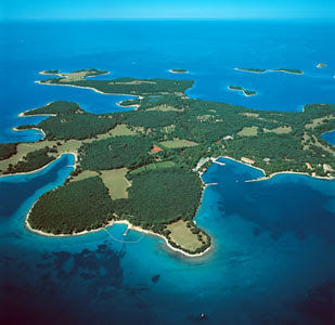
National park Brijuni (CRO)
Brijuni or Brioni are a group of 14 lager and small islands in the Croatian part of the northern Adriatic Sea, separated from the west coast of the Istrian peninsula by the narrow Fažana Strait. The largest island, Veli Brijun ("Big Brijun") (5.6 km²), lies 2 km off the coast. Famous for their scenic beauty, the islands are a holiday resort and a Croatian National Park.
Brijuni were proclaimed a national park in 1983.The islands abound with Mediterranean and sub-Mediterranean vegetation, where tourists can take in the surroundings of untouched nature. The island has a zoo, pheasant farm and safari park with numerous diverse forms of animal life from throughout the world.Traces of human inhabitation on the island date back to the earlier neolithic period and among the many archaeological sites, the most significant is the pre-historic settlement on Gradina hill.
Friday, August 24, 2007
National parks in Croatia
National parks of Croatia.
In next posts for all nature lovers I will describe 8 national parks of Croatia. For begin it is very important to say what actually words "NATIONAL PARK" mean. Because of that I have given the definition of national park.
"National park is an area less affected by human exploitation and occupation, with sites of particular scenic or scientific interest, which is protected by a national authority."
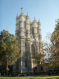
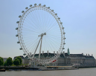
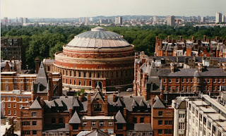
Best places in London to visit!
Buckingham Palace
The Palace of Westminster
The Millennium Bridge
Tower Bridge
Westminster Abbey
Wembley Stadium
London Eye
The Royal Albert Hall
Royal Holloway
Greenwich Park
City Hall
History of London
John Norden's map of London in 1593
London has quite big history.
I will present to you some basic staff form some parts of Londons history:
According to the legendary Historia Regum Britanniae, of Geoffrey of Monmouth, London was founded by Brutus of Troy after he defeated the incumbent giants Gog and Magog and was known as Caer Troia, Troia Nova, or New Troy, which, according to a pseudo-etymology, was corrupted to Trinovantum.
Early Roman London occupied a relatively small area, roughly equivalent in size to Hyde Park. In around AD 60, it was sacked by the Iceni led by their queen Boudica. However, the city was quickly rebuilt as a planned Roman town and recovered after perhaps 10 years, the city growing rapidly over the following decades. During the 2nd century Londinium was at its height and replaced Colchester as the capital of Roman Britain (Britannia). Its population was around 60,000 inhabitants.
In the 7th Century a Saxon village and trading centre named Lundenwic ("London settlement") was established approximately one mile to the west of Londinium. The new town came under direct Mercian control in c.730 as the East Saxon kingdom of which it had once been part was gradually reduced in size and status. Mercian lordship was replaced by that of Wessex after 825.
This is just small part of Londons History, other parts are:
-Norman and Medieval London
-Tudor London (1485-1603)
-Stuart London (1603–1714)
-18th century London
-19th century London
-20th century London
-London in World War II
-London 1945–2000
-21st century London
All informations about history you can find on wikipedia.
Tuesday, August 21, 2007
London
Londons coat of arms
Londons flag
London is the capital city of England and the United Kingdom. The ancient City of London to which the name originally belonged still retains its tiny mediaeval boundaries; but the name "London" has long applied more generally to the whole metropolis which has grown up around it.
An important settlement for around two millennium. London is business, financial and cultural center of England and United Kingdom. It is one of most important city in EU because it is also politics, education, media and arts center of EU.
In London live 7.7 mil. people and as metropolitan area between 12 and 14 mil. people. There is 300 different languages which are spoken in London.
It is also an international transport hub, with five international airports and a large port. It serves as the largest aviation hub in the world, and its main airport, the multi terminal Heathrow, carries more international passengers than any other airport in the world. It has Europe's largest underground railway system when measured by route length.
This informations are taken from Wikipedia.
Places which you must visit in Paris!
Eiffel tower
Seine
Churchill and the Petit Palais
Cemetery of Père Lachaise
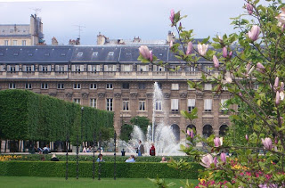
Jardins du Palais Roya
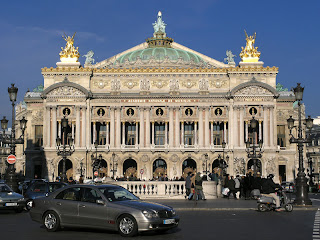
Opéra Garnier
Parc Monceau
Saint-Germain l'Auxerrois
Sunday, August 19, 2007
Blitz history of Paris.
picture by: Pierre Puvis de Chevannes, 1881
From small fishing village to famous town of fashion.
Paris is more than 2,000 years old. Gauls of the Parisii tribe settled there between 250 and 200 BC and founded a fishing village on an island in the river that is the present-day Ile de la Cité -- the center around which Paris developed.
Around AD 500, Paris was the capital of the Frankish king Clovis I, who commissioned the first chatedral and its first abbey dedicated to hic contemporary, later patron saint of the city, Sainte Geneviève.
The Industial Revolution, the Franch Second Empire , and the Belle Époque brought Paris the greatest development in its history. From the 1840s, rail transport allowed an unprecedented flow of migrants into Paris attracted by employment in the new industries in the suburbs
During Wprld War I, Paris was at the forefront of the war effort, having been spared a German invasion by the French and British victory at the First Battle of the Marne in 1914. In 1918-1919, it was the scene of Allied victory parades and peace negotiations. In the inter-war-period Paris was famed for its cultural and artistic communities and its nightlife. The city became a gathering place of artists from around the world, from exiled Russian composer Stravinsky and Spanish painter Picasso to American writer Hemingway.
Paris - town of love!
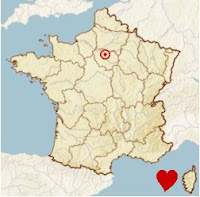
Paris location
Paris blazon
Paris enjoys a temperate climate. Average daily temperatures are 20°C (68°F) in summer and 5°C (41°F) in winter. The city receives about 650 mm (26 in) of precipitation annually, spread evenly over the course of the year.
Paris blazon
Paris is capital city of France. It is located in France’s Île-de-France region
on boath side river Seine. It have very big poputalion, there live 2,125.246 habitants. Paris is cultural, political, industrial and commercial center in France. It is also wellknown in world like focus of art and fashion. In Paris you can find: all kind of industrial, especialy: parfumes, jewelry, fashions articles and much more. Paris have big touristic offer so it have very big number of turist. One of the faster, but most expensive way to go in Paris is by airoplain. There 2 big international airports in Paris: Charles de Gaulle and Orly. There is also airport Le Bourget for host transporting.
Paris enjoys a temperate climate. Average daily temperatures are 20°C (68°F) in summer and 5°C (41°F) in winter. The city receives about 650 mm (26 in) of precipitation annually, spread evenly over the course of the year.
Friday, August 17, 2007
Picture of places which you must visit in Prague!
Church Sv. Vitl
St. Vitus Cathedral
Old squer
Parlament
Old part of town
Old part of town
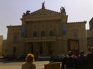
National museum
Madam buterfly
Famous colck
Thursday, August 16, 2007
History of Prague
Prague, which covers an area of 496 sq km (192 sq mi), was formed in 1920 by incorporation of 37 nearby towns and villages. Greater Prague also includes numerous new suburban developments dominated by high-rise apartments that date from the Communist era. Prague (Chezh Republic) was part of Chezhoslovakia since 14 years ago, when Chezhoslovakia became 2 republick (Chezh and Slovakia)
The historic center of the city developed in a broad valley on the banks and surrounding hills of the Vltava River. Many bridges link the two parts of the city. The most famous of these is the Charles Bridge (legend : on Charles Bridge exist opertunity to make wish DO NOT miss it!), commissioned in the late 14th century by Holy Roman Emperor Charles IV, completed in the early 15th century and later embellished with statues of saints. Old Town, founded in the 13th century, and New Town, which developed in the 14th century, lie on the eastern bank of the river. Old Town contains many important architectural and artistic monuments, several of them situated on Old Town Square.
Prague
Pragues flag
Coat of arms
Basic stuff about Prague:location: Central Europe
size: 496 sq km (192 sg mi)
population: 1,169,106 (informations from 2003.)
Prague (Czech Praha) is capital and largest city of the Czech Republic. It is located in the west part of the country in the region of Bohemia. Because of its many beautyful churches and towers Prague is often called "The City of Hundred Spires". Prague is the most important comercial, industrial and curtular center of the Czech Republic. During The World War II many towns of central eropean were demaged or completely destroyed, but Prague is exeption. Because of that it remains one of the most beautiful citys on the continent.
Wednesday, August 15, 2007
Earth
Everybody knows how big is Earth, but nobody knowns every Earths hidden beauty. This blog is opened to present people how nice is Earth, and another reason is to present locations on Earth which you must visit! I will try to present different kind of locations because I want that everyone find location for self and which he/she want to visit. I hope that I will succeed in this ambition. Bye!
Subscribe to:
Posts (Atom)